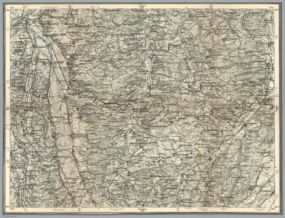
1895
Reichsamt fur Landesaufnahme
1:100k
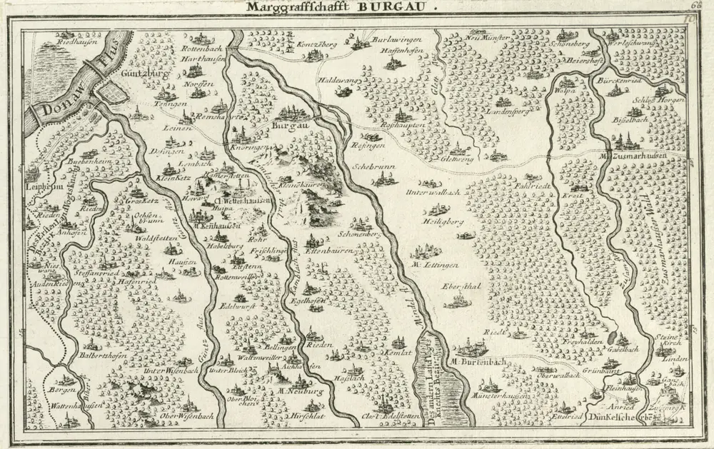
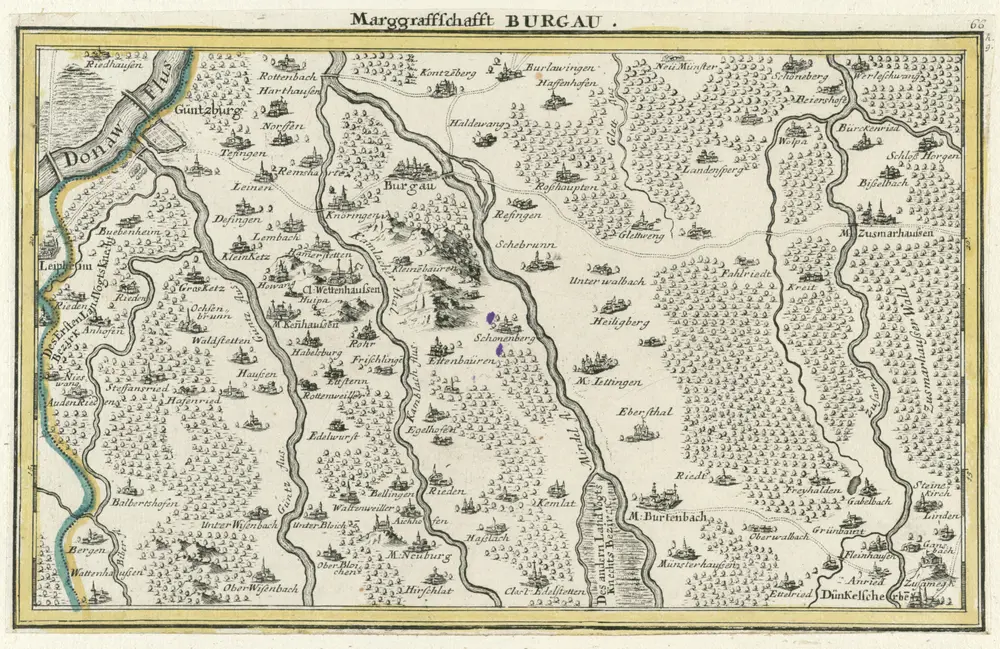
1725
Bodenehr, Gabriel
1730
1820
1:245k
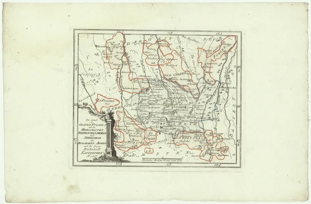
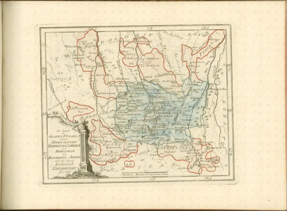
1791
Reilly, Franz Johann Josef von
1758
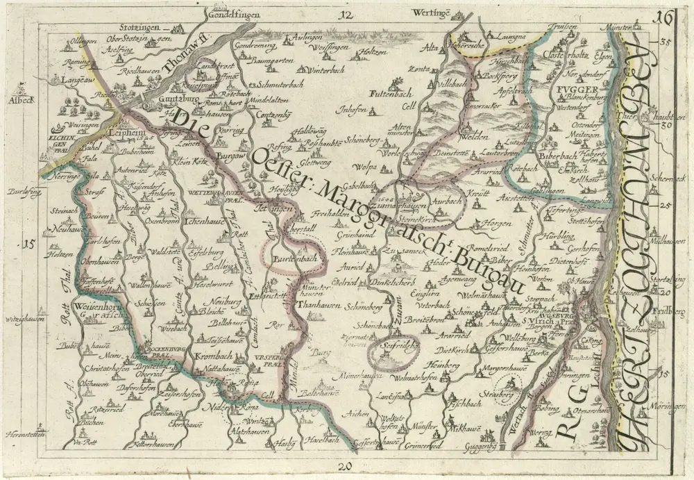
Hurter, Johann Christoph
1714
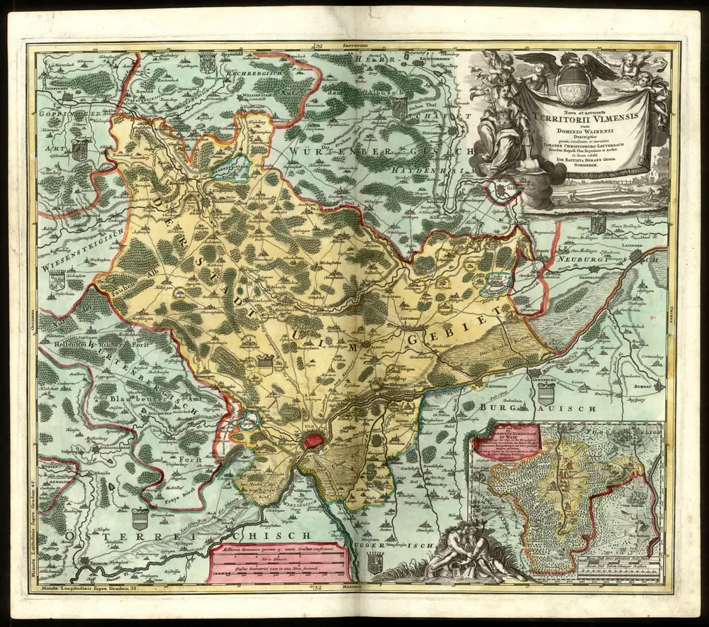
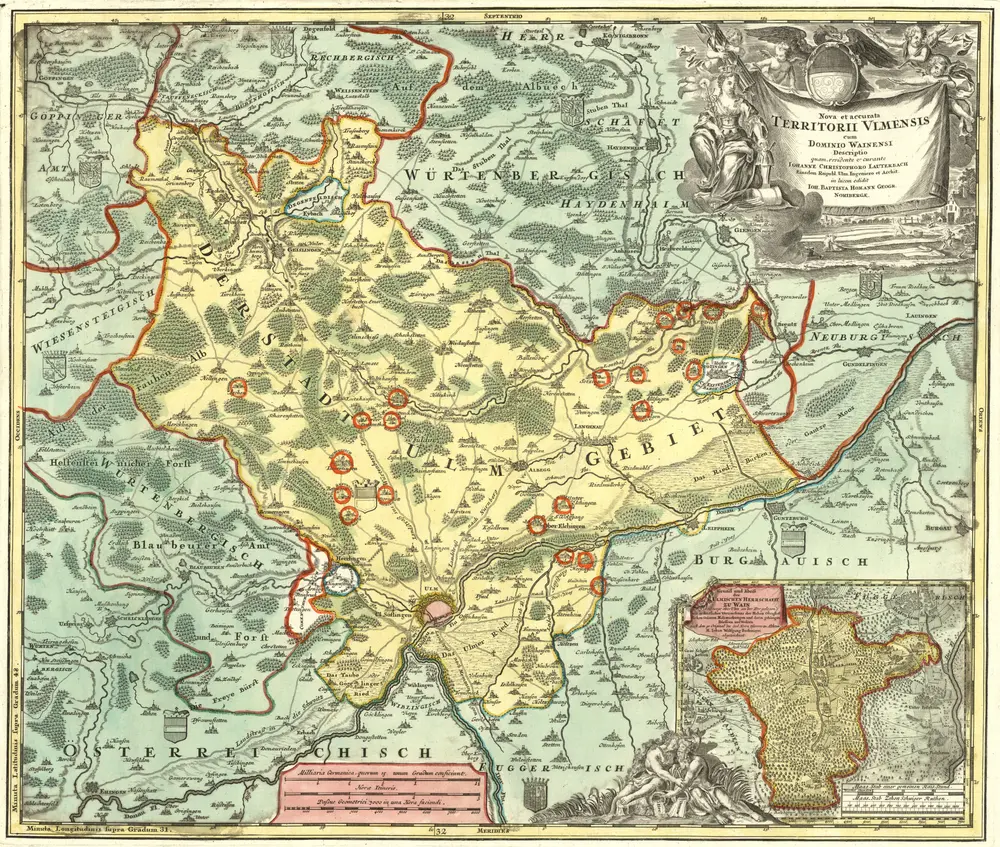
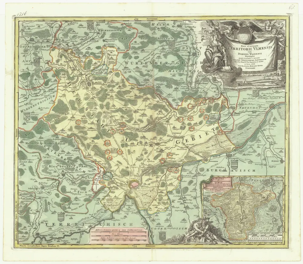
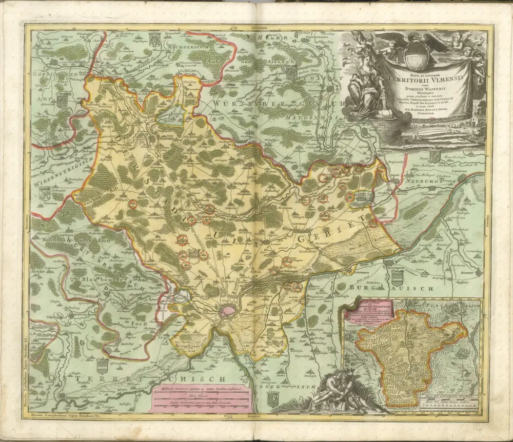
Homann Johann Baptist
1724
Lauterbach, Johann Christoph
1716
Homann, Johann Baptist