Proyecto
Comunidad
Noticias
Mi aplicación
Mis mapas
Mapas de Ala-Suhka
Búsqueda avanzada
Todos
Privado
Favoritos
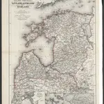
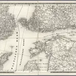
Russische Ost-See-Provinzen Livland, Esthland und Kurland
1867|Issleib, Wilhelm
1:1 350 000
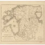
Topographische Charte von Liw-Laett u. Eestland zu Anfang des 13ten Jahrhunderts
1828
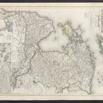
Die Russischen Ost-See-Provinzen Livland Ehstland und Kurland
1860|Meyer, J.
Stockholm, IV
1870|Schubert, Friedrich Theodor
1:1 400 000
Stockhom. IV
1837|Schubert, Friedrich Theodor
1:1 400 000
Russland: Gouvernement Sankt Petersburg, Esthland, Liefland, Kurland
1854|Renner, L.
1:3 500 000
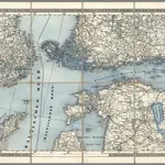
A panoramic view of the Gulf of Finland & the Baltic sea, with the fortified places from the Aland isles to St. Petersburg
1855|Packer, Thomas
1600
1650
1700
1750
1800
1850
1900
1950
2000
Historia
Mapas antiguos de Ala-Suhka
Descubra el pasado de Ala-Suhka en mapas históricos
Mapas antiguos de Ala-Suhka
Descubra el pasado de Ala-Suhka en mapas históricos
Explorar los mapas
Descubrir la historia
Región paterna
Condado de Võru
Lugares relacionados
© MapTiler
© OpenStreetMap
 1867|Issleib, Wilhelm1:1 350 000
 1828
1828
 1860|Meyer, J.
 1870|Schubert, Friedrich Theodor1:1 400 000
 1837|Schubert, Friedrich Theodor1:1 400 000
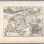 1854|Renner, L.1:3 500 000
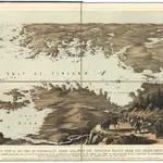 1855|Packer, Thomas