Project
Community
News
My App
My maps
Maps of Rouelles
Advanced search
All
Private
Favorites
Langres 139, uit: [W. Liebenow's Special-Karte von Mittel-Europa]
1870|Johannes Wilhelm Liebenow 1822-1897
1:300 000
Haute-Marne.
1869|Migeon, J.
1:147 060
Département de la Haute Marne
1810|P. G. Chanlaire
1:260 000
Cote-d'Or.
1869|Migeon, J.
1:175 440
Dept. De La Cote D'Or.
1856|Levasseur, Victor.
1:563 000
Département de la Côte d'Or
1810|P. G. Chanlaire et Dumez
1:260 000
Cassell's Illustrated History of the War between France and Germany, 1870-1871
1871|OLLIER, Edmund.
1600
1650
1700
1750
1800
1850
1900
1950
2000
History
Old maps of Rouelles
Discover the past of Rouelles on historical maps
Old maps of Rouelles
Discover the past of Rouelles on historical maps
Explore Maps
Discover History
Parent places
Arrondissement of Langres
Related places
© MapTiler
© OpenStreetMap
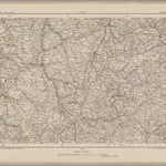 1870|Johannes Wilhelm Liebenow 1822-18971:300 000
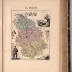 1869|Migeon, J.1:147 060
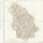 1810|P. G. Chanlaire1:260 000
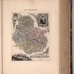 1869|Migeon, J.1:175 440
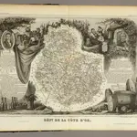 1856|Levasseur, Victor.1:563 000
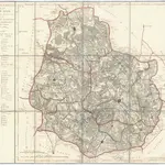 1810|P. G. Chanlaire et Dumez1:260 000
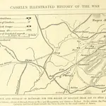 1871|OLLIER, Edmund.