Project
Community
News
My App
My maps
Maps of Komádi
Advanced search
All
Private
Favorites
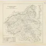
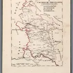
Süd-Biharer Comitat
1840
1:288 000
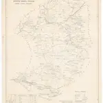
Comitat Békés Csanád
1840
1:290 000
Comitat Nord-Bihar
1840
1:288 000
Grosswardein
1873|Militärgeographisches Institut
1:300 000
V.3:11-15:XII: 2. Oesterreich. C. Ungarische erbstaaten, I. Koenigr: Ungarn, Gespanschaft 37-38, 46a
1828|Hermann, O.
1:200 000
V.3:11-15:XII: 2. Oesterreich. C. Ungarische erbstaaten, I. Koenigr: Ungarn, Gespanschaft 41-42, 44
1828|Hermann, O.
1:200 000
IX, uit: General-Karte des oesterreichischen Kaiserstaates mit einem grossen Theile der angrenzenden Länder / durch Josef Scheda ... bearb. und hrsg
1856|[Wien : K.K. Militärisch-Geografisches Institut]
1:576 000
1600
1650
1700
1750
1800
1850
1900
1950
2000
History
Old maps of Komádi
Discover the past of Komádi on historical maps
Old maps of Komádi
Discover the past of Komádi on historical maps
Explore Maps
Discover History
Parent places
Berettyóújfalu District
Related places
© MapTiler
© OpenStreetMap
 18401:288 000
 18401:290 000
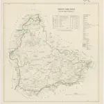 18401:288 000
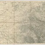 1873|Militärgeographisches Institut1:300 000
 1828|Hermann, O.1:200 000
 1828|Hermann, O.1:200 000
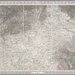 1856|[Wien : K.K. Militärisch-Geografisches Institut]1:576 000