Project
Community
News
My App
My maps
Maps of Kerecsend
Advanced search
All
Private
Favorites
Schlacht bei Kápolna, am 27ten Febr. 1849
1849
1:370 000
Umgebungen von Erlau und Gyöngyös
1873|Militärgeographisches Institut
1:144 000
Comitat Heves
1840
1:290 000
Borsoder Comitat
1840
1:288 000
Borsoder Comitat
1840
1:288 000
Umgebungen von Mezőkövesd
1872|Militärgeographisches Institut
1:144 000
Comitate zwischen Pressburg u. Debreczin 1848, 1849
1848
1:2 775 000
1600
1650
1700
1750
1800
1850
1900
1950
2000
History
Old maps of Kerecsend
Discover the past of Kerecsend on historical maps
Old maps of Kerecsend
Discover the past of Kerecsend on historical maps
Explore Maps
Discover History
Parent places
Eger District
Related places
© MapTiler
© OpenStreetMap
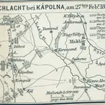 18491:370 000
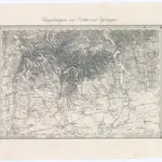 1873|Militärgeographisches Institut1:144 000
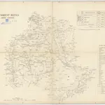 18401:290 000
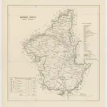 18401:288 000
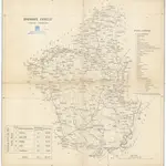 18401:288 000
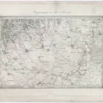 1872|Militärgeographisches Institut1:144 000
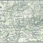 18481:2 775 000