Project
Community
News
My App
My maps
Maps of Garfield, Washington
Advanced search
All
Private
Favorites
Map of Public Surveys, Washington Territory, 1863
1863|U.S. General Land Office
Idaho.
1875|Cram Atlas Company
1:1 330 560
Washington.
1874|Asher & Adams
1:1 267 200
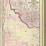
Idaho, Montana Western Portion.
1875|Asher & Adams
1:1 280 000
Map of Public Surveys in the Territory of Washington,1862
1862|U.S. General Land Office
Oregon and Washington.
1874|Johnson, A.J.
1:2 550 000
Rocky Mountains to Puget Sound.
1861|Stevens, Isaac I.
1:1 200 000
1600
1650
1700
1750
1800
1850
1900
1950
2000
History
Old maps of Garfield, Washington
Discover the past of Garfield, Washington on historical maps
Old maps of Garfield, Washington
Discover the past of Garfield, Washington on historical maps
Explore Maps
Discover History
Parent places
Whitman County, Washington
Related places
© MapTiler
© OpenStreetMap
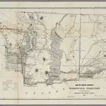 1863|U.S. General Land Office
 1875|Cram Atlas Company1:1 330 560
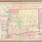 1874|Asher & Adams1:1 267 200
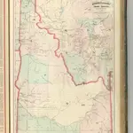 1875|Asher & Adams1:1 280 000
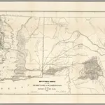 1862|U.S. General Land Office
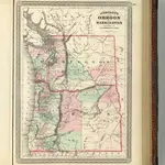 1874|Johnson, A.J.1:2 550 000
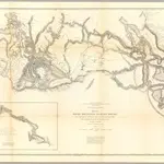 1861|Stevens, Isaac I.1:1 200 000