Project
Community
News
My App
My maps
Maps of Frapelle
Advanced search
All
Private
Favorites
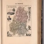
Haut-Rhin.
1869|Migeon, J.
1:116 280
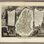
Dept. Du Haut Rhin.
1856|Levasseur, Victor.
1:571 000
Colmar 140, uit: [W. Liebenow's Special-Karte von Mittel-Europa]
1870|Johannes Wilhelm Liebenow 1822-1897
1:300 000
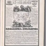
85. Vosges. Epinal (Lorraine)
1842|Rivaux, Auguste
Dept. Du Bas Rhin.
1856|Levasseur, Victor.
1:455 000
Bas-Rhin.
1869|Migeon, J.
1:147 060
[Atlas départemental : La France et ses colonies] No. 53 Meurthe
1836|publ. par Michel fils ainé
1:670 000
1600
1650
1700
1750
1800
1850
1900
1950
2000
History
Old maps of Frapelle
Discover the past of Frapelle on historical maps
Old maps of Frapelle
Discover the past of Frapelle on historical maps
Explore Maps
Discover History
Parent places
Arrondissement of Saint-Dié-des-Vosges
Related places
© MapTiler
© OpenStreetMap
 1869|Migeon, J.1:116 280
 1856|Levasseur, Victor.1:571 000
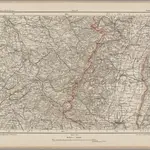 1870|Johannes Wilhelm Liebenow 1822-18971:300 000
 1842|Rivaux, Auguste
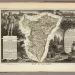 1856|Levasseur, Victor.1:455 000
 1869|Migeon, J.1:147 060
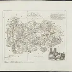 1836|publ. par Michel fils ainé1:670 000