Project
Community
News
My App
0
My maps
Maps of Borough of Hartlepool
Advanced search
All
Private
Favorites
Yorkshire 6a - OS Six-Inch Map
1853|Ordnance Survey
1:10 560
Durham XLV - OS Six-Inch Map
1855|Ordnance Survey
1:10 560
Durham XXXVII - OS Six-Inch Map
1857|Ordnance Survey
1:10 560
Durham XLIV - OS Six-Inch Map
1856|Ordnance Survey
1:10 560
Durham XXXVI - OS Six-Inch Map
1856|Ordnance Survey
1:10 560
Durham XXXVI.12 (includes: Elwick Hall; Elwick; Embleton; Hart; Sheraton With Hulam) - 25 Inch Map
1856|Ordnance Survey
1:2 500
103. Durham.
1868|Great Britain. Board of Ordnance
1:63 360
1600
1650
1700
1750
1800
1850
1900
1950
2000
History
Old maps of Borough of Hartlepool
Discover the past of Borough of Hartlepool on historical maps
Old maps of Borough of Hartlepool
Discover the past of Borough of Hartlepool on historical maps
Explore Maps
Discover History
Parent places
England
Related places
© MapTiler
© OpenStreetMap
 1853|Ordnance Survey1:10 560
 1855|Ordnance Survey1:10 560
 1857|Ordnance Survey1:10 560
 1856|Ordnance Survey1:10 560
 1856|Ordnance Survey1:10 560
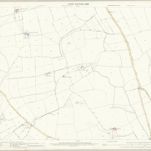 1856|Ordnance Survey1:2 500
 1868|Great Britain. Board of Ordnance1:63 360