Japan, Mandshuria (showing the course of the Amur river), the Kurile Isles &c. : according to the British & Russian Admiralty surveys, Krusenstern, Siebold &c. / by J. Bartholomew Jun.r ; engraved by J. Bartholomew
1860|Bartholomew, John (1831-1893)1:9 000 000
Karte der Reichsgrenze zwischen Russland und China
18741:8 500 000
Japan, an account geographical and historical, from the earliest period at which the Islands composing this Empire were known to Europæans down to the present time ... With illustrations from designs by A. Allom
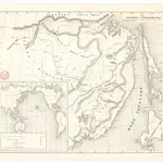 1860|H. Seifert
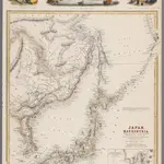 1860|Bartholomew, John (1831-1893)1:9 000 000
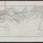 18741:8 500 000
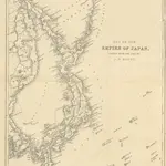 1852|MACFARLANE, Charles.
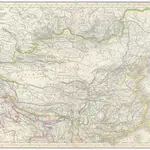 1839|Grimm, J. L.1:12 760 000
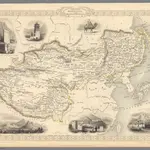 1851|Tallis, J. & F.1:19 008 000
 1843|H.B.