Projekt
Gemeinschaft
Nachrichten
Meine App
Meine Karten
Karten von Bull Run
Erweiterte Suche
Alle
Privat
Favoriten
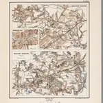
Planche XXVII. Bristow Station (Virginie). Manassas Gap (Virginie). Brandy Station (Virginie).
1875|Le Comte de Paris
1:80 000
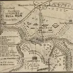
Map of the Position of Forces at Bull Run
1861|L. Prang & Co.
Wisconsin in the War of the Rebellion; a history of all regiments and batteries the State has sent into the field, etc. [With portraits.]
1866|LOVE, William de Loss D.D
Balloon View of the Battle-ground between Washington, Manassas Junctn. & Fredericksburg.
1861|L. Prang & Co.
Map of the Battle Ground, showing 5 mile distances from Washington
1861|L. Prang & Co.
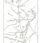
Map Of N. Eastern Virginia And Vicinity Of Washington
1862|U.S. War Department, Topographical Engineers
1:63 360
Culpepper County
1859|L. V. Buchholts
1:322 169
1600
1650
1700
1750
1800
1850
1900
1950
2000
Geschichte
Alte Karten von Bull Run
Entdecken Sie die Vergangenheit von Bull Run auf historischen Karten
Alte Karten von Bull Run
Entdecken Sie die Vergangenheit von Bull Run auf historischen Karten
Karten erkunden
Geschichte entdecken
Übergeordnete Region
Prince William County
Verwandte Orte
© MapTiler
© OpenStreetMap
 1875|Le Comte de Paris1:80 000
 1861|L. Prang & Co.
 1866|LOVE, William de Loss D.D
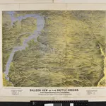 1861|L. Prang & Co.
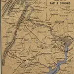 1861|L. Prang & Co.
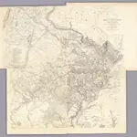 1862|U.S. War Department, Topographical Engineers1:63 360
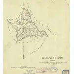 1859|L. V. Buchholts1:322 169